School nearby School 66
Uzbekistan
School nearby School 66
School 66
9, Lobixovuz ko'chasi, 100115, Тошкент, UZ Uzbekistán
contacts phone
:
+998 71 277 10 29
Latitude:
41.2854171
, Longitude:
69.2283394
larger map & directions
read more
nearest School
127 m
Detskiy Sad 212
Ташкент 100115
School
read more
133 m
Monday Education o'quv markazi
ул. Чиланзарская, дом 6 Ташкент UZ
School
read more
207 m
Istedodli Klajak Yoshlari School
Tashkent
School
read more
207 m
Istedodli Kelajak Yoshlari School
Tashkent
School
read more
249 m
Детсад #200 Орзу
Tashkent
School
read more
323 m
School №103
53 Гагарин кўчаси, Тошкент
School
read more
429 m
School 168
20, Тошкент
School
read more
430 m
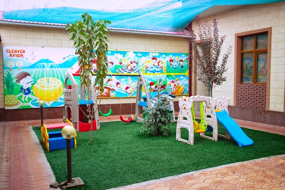
Clever Junior
Toshkent Xalqa Avtomobil Yo'li, Тошкент
School
read more
547 m
Clever Junior Частный Детский Сад
Tashkent
School
read more
576 m
Model'noye Akademiya
3,Ташкент 100115
School
read more
591 m
School 162
52, Тошкент
School
read more
780 m
School 144
2 Sirajiddinov Street, Tashkent
School
read more
1.281 km
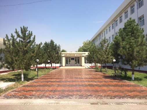
O'zDJTU qoshidagi 3-son akademik litsey
Tashkent
School
read more
1.323 km
Erkatoy-Kichkintoy
Tashkent
School
read more
1.434 km
Textile Institute
Shoxdjaxon ko'chasi, 5
School
Point of interest
Establishment
read more
1.63 km
Школа №135
Tashkent
School
read more
1.657 km
Active Training Center
65a, Usmon Nosir ko'chasi, Тошкент
School
read more
1.76 km
TTYeSI qoshidagi akademik litsey
5 Shoxdjaxon ko'chasi, Тошкент
School
read more
1.847 km
GET CLUB INNOVATSION TIL MAKTABI
Navoiy 27 uy TASHKENT TASHKENT CITY
School
read more
1.866 km
26 Shkola
Tashkent
School
read more
2.016 km
Future Education
Bobur ko'chasi, Тошкент
School
read more
2.113 km
Yakkasarayskiy Professional'nyy Kolledzh Sfery Uslug
Qushbegi ko'chasi, Тошкент
School
read more
2.211 km
Fakul'tet Pedinstituta
Tashkent
School
read more
2.537 km
Kindergarten 116 Lola
Tashkent
School
read more
2.633 km
Gsosh 180
Tashkent
School
read more
📑
all categories
Accounting
Administrative area level 1
Administrative area level 2
Airport
Amusement park
Art gallery
Atm
Bakery
Bank
Bar
Beauty salon
Bicycle store
Book store
Bowling alley
Bus station
Cafe
Campground
Car dealer
Car rental
Car repair
Car wash
Cemetery
Church
City hall
Clothing store
Colloquial area
Convenience store
Courthouse
Dentist
Department store
Doctor
Electrician
Electronics store
Embassy
Establishment
Finance
Fire station
Florist
Food
Furniture store
Gas station
General contractor
Grocery or supermarket
Gym
Hair care
Hardware store
Health
Hindu Temple
Home goods store
Hospital
Insurance agency
Jewelry store
Laundry
Lawyer
Library
Liquor store
Local government office
Locality
Locksmith
Lodging
Meal delivery
Meal takeaway
Mosque
Movie theater
Moving company
Museum
Natural feature
Neighborhood
Night club
Park
Parking
Pet store
Pharmacy
Place of worship
Plumber
Point of interest
Police
Political
Post office
Premise
Real estate agency
Restaurant
Roofing contractor
Route
Rv park, camping
School
Shoe store
Shopping mall
Spa
Stadium
Storage
Store
Subway station
Supermarket
Synagogue
Taxi stand
Train station
Transit station
Travel agency
University
Veterinary care
Zoo
sublocality level 1
↑