School nearby iSpeak - Учебный Центр
Uzbekistan
School nearby iSpeak - Учебный Центр
iSpeak - Учебный Центр
28-60, Ahmad Donish ko'chasi, 100093, Тошкент, UZ Uzbekistan
contacts phone
:
+998 95 195 60 30
Latitude:
41.362428
, Longitude:
69.2833884
larger map & directions
read more
nearest School
371 m
Kindergarten 91
Tashkent
School
read more
397 m
Kindergarten 480
Tashkent
School
read more
407 m
School 302
Moyqo'rg'on ko'chasi, Тошкент
School
read more
657 m
School 220
Moyqo'rg'on ko'chasi, Тошкент
School
read more
761 m
School No.272
Tashkent
School
read more
784 m
iSpeak Yunusobob filial
47 Ahmad Donish ko'chasi, Тошкент
School
read more
841 m
MERIT
129B, Amir Temur street, Yunusabad District
School
read more
923 m
Ademic Lyceum at Tashkent Chemical-Technological Institute
7, Тошкент
School
read more
1.11 km
Школа №63
Tashkent
School
read more
1.178 km
Detskiy Sad Boychechak
62 Ahmad Donish ko'chasi, Тошкент
School
read more
1.201 km
Detskiy Sad 366
Юнусабадский район
School
read more
1.311 km
School 246
Tashkent
School
read more
1.478 km
Yunusabadskiy Akademicheskiy Litsey Inostrannykh Yazykov Pri Tashgiv
Tashkent
School
read more
1.484 km
Toshkent Davlat Sharqshunoslik Instituti Qoshidagi Yunusobod Xorijiy Tillar Akademik Litseyi
Tashkent
School
read more
1.494 km
Academic Lyceum Of Foreign Languages Under The State Of Univercity Of Oriental Languages
Yunusabad-7, Tashkent
School
read more
1.506 km
School 86
Moyqo'rg'on ko'chasi, Тошкент
School
read more
1.588 km
School 12
Taskent
School
read more
1.595 km
Mtm 506 Detskiy Sad
улица Мойкурган, Тошкент
School
read more
1.673 km
Barkamol Avlod Tashkent
Yunusabad-6, Tashkent
School
read more
1.864 km
School 265
Tashkent
School
read more
1.931 km
Kindergarten 136
Tashkent
School
read more
1.974 km
№221 Карамелька
детский сад,Yuqori Qoraqamish Street,Ташкент 100212
School
read more
2.021 km
Shkola 150
Tashkent
School
read more
2.354 km
247-Мактаб
Taschkent
School
read more
2.583 km
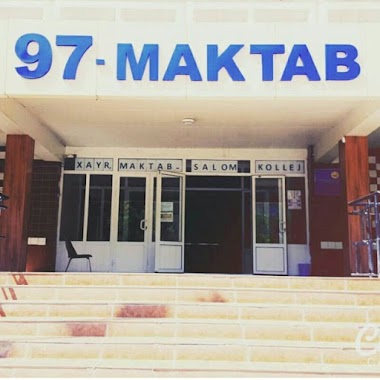
Shkola 97
Tashkent
School
read more
📑
all categories
Accounting
Administrative area level 1
Administrative area level 2
Airport
Amusement park
Art gallery
Atm
Bakery
Bank
Bar
Beauty salon
Bicycle store
Book store
Bowling alley
Bus station
Cafe
Campground
Car dealer
Car rental
Car repair
Car wash
Cemetery
Church
City hall
Clothing store
Colloquial area
Convenience store
Courthouse
Dentist
Department store
Doctor
Electrician
Electronics store
Embassy
Establishment
Finance
Fire station
Florist
Food
Furniture store
Gas station
General contractor
Grocery or supermarket
Gym
Hair care
Hardware store
Health
Hindu Temple
Home goods store
Hospital
Insurance agency
Jewelry store
Laundry
Lawyer
Library
Liquor store
Local government office
Locality
Locksmith
Lodging
Meal delivery
Meal takeaway
Mosque
Movie theater
Moving company
Museum
Natural feature
Neighborhood
Night club
Park
Parking
Pet store
Pharmacy
Place of worship
Plumber
Point of interest
Police
Political
Post office
Premise
Real estate agency
Restaurant
Roofing contractor
Route
Rv park, camping
School
Shoe store
Shopping mall
Spa
Stadium
Storage
Store
Subway station
Supermarket
Synagogue
Taxi stand
Train station
Transit station
Travel agency
University
Veterinary care
Zoo
sublocality level 1
↑