School nearby 247-Мактаб
Uzbekistan
School nearby 247-Мактаб
247-Мактаб
Taschkent 100180, Usbekistan
contacts phone
:
+998
Latitude:
41.3781539
, Longitude:
69.3022806
larger map & directions
read more
nearest School
246 m
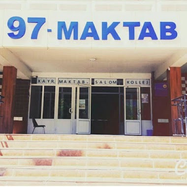
Shkola 97
Tashkent
School
read more
553 m
Kindergarten 136
Tashkent
School
read more
999 m
School 12
Taskent
School
read more
1.086 km
2-son Bolalar-o'smirlar sport maktabi
Tashkent
School
read more
1.121 km
258-Shkola
Tashkent
School
read more
1.13 km
Oltin Qanot
17Б, Тошкент
School
read more
1.166 km
School #258
Tashkent
School
read more
1.174 km
257
Tashkent
School
read more
1.178 km
Detskiy Sad Boychechak
62 Ahmad Donish ko'chasi, Тошкент
School
read more
1.283 km
School 246
Tashkent
School
read more
1.384 km
Детский сад №494
Yunusota ko'chasi, Тошкент
School
read more
1.457 km
Kindergarten 555
Tashkent
School
read more
1.463 km
School 265
Tashkent
School
read more
1.585 km
№221 Карамелька
детский сад,Yuqori Qoraqamish Street,Ташкент 100212
School
read more
1.602 km
iSpeak Yunusobob filial
47 Ahmad Donish ko'chasi, Тошкент
School
read more
1.609 km
Kindergarten #499
Tashkent
School
read more
1.721 km
Ademic Lyceum at Tashkent Chemical-Technological Institute
7, Тошкент
School
read more
1.916 km
School 260
Tashkent
School
read more
2.26 km
Kindergarten 91
Tashkent
School
read more
2.354 km
iSpeak - Учебный Центр
28-60 Ahmad Donish ko'chasi, Тошкент
School
read more
2.532 km
School 302
Moyqo'rg'on ko'chasi, Тошкент
School
read more
2.63 km
School 220
Moyqo'rg'on ko'chasi, Тошкент
School
read more
2.634 km
Kindergarten 480
Tashkent
School
read more
2.773 km
MERIT
129B, Amir Temur street, Yunusabad District
School
read more
3.32 km
Detskiy Sad 228
Namangan Str., Тошкент
School
read more
📑
all categories
Accounting
Administrative area level 1
Administrative area level 2
Airport
Amusement park
Art gallery
Atm
Bakery
Bank
Bar
Beauty salon
Bicycle store
Book store
Bowling alley
Bus station
Cafe
Campground
Car dealer
Car rental
Car repair
Car wash
Cemetery
Church
City hall
Clothing store
Colloquial area
Convenience store
Courthouse
Dentist
Department store
Doctor
Electrician
Electronics store
Embassy
Establishment
Finance
Fire station
Florist
Food
Furniture store
Gas station
General contractor
Grocery or supermarket
Gym
Hair care
Hardware store
Health
Hindu Temple
Home goods store
Hospital
Insurance agency
Jewelry store
Laundry
Lawyer
Library
Liquor store
Local government office
Locality
Locksmith
Lodging
Meal delivery
Meal takeaway
Mosque
Movie theater
Moving company
Museum
Natural feature
Neighborhood
Night club
Park
Parking
Pet store
Pharmacy
Place of worship
Plumber
Point of interest
Police
Political
Post office
Premise
Real estate agency
Restaurant
Roofing contractor
Route
Rv park, camping
School
Shoe store
Shopping mall
Spa
Stadium
Storage
Store
Subway station
Supermarket
Synagogue
Taxi stand
Train station
Transit station
Travel agency
University
Veterinary care
Zoo
sublocality level 1
↑