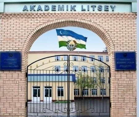
School nearby 129-maktab
Uzbekistan
School nearby 129-maktab
129-maktab
Nazarbek ko'chasi, Тошкент, UZ Uzbekistan
contacts phone
:
+998 71 247 78 62
Latitude:
41.3078743
, Longitude:
69.1688919
larger map & directions
read more
nearest School
368 m
Beshqayrag'och Ibrat Ko'cha
улица Ибрат дом 47, Тошкент
School
read more
924 m
Shkola Orom
Khandamir Str., Тошкент
School
read more
964 m
Школа № 116 учтепинский район
Beshqayrag'och ko'chasi, Тошкент
School
read more
1.725 km
81-Shkola
Tashkent
School
read more
1.739 km
School 228
Foziltepa ko'chasi, Тошкент
School
read more
1.766 km
Школа №238
Foziltepa ko'chasi, Тошкент
School
read more
2.206 km
School 229
Tashkent
School
read more
2.364 km
The school No.62
Chilanzar-14, Tashkent
School
read more
2.517 km
Obshcheobrazovatel'naya Shkola - 106
Tashkent
School
read more
2.729 km
Wise School
Учтепинский район, улица Лутфий
School
read more
2.731 km
REGISTON O'quv markazi
Чиланзар-9а, Tashkent
School
read more
2.807 km
School 262
Tashkent
School
read more
2.947 km
School #186
1 Orifon köchasi, Тошкент
School
read more
2.994 km
Registon o‘quv markazi (Shirin filiali)
г.Ташкент Учтепенский район улица Лутфи дом 65А Ташкент Ташкент UZ
School
read more
3.009 km
Perfect English
36 Lutfi ko'chasi, Тошкент
School
read more
3.127 km
Akademik litsey Sa'di Hasanovich Sirojiddinov nomli
Tashkent
School
read more
3.127 km
S.H.Sirojiddinov nomidagi akademik litsey
Tashkent
School
read more
3.163 km
Academic Lyceum under the National University Of Uzbekistan Named After S.H.Sirojiddinov
Tashkent
School
read more
3.268 km
314-MTM
Tashkent
School
read more
3.438 km
Школа №183
Tashkent
School
read more
3.527 km
BUXORO FAN
Tashkent
School
read more
3.583 km
School 181
26 Kichik Xalqa Yo'li, Тошкент
School
read more
3.652 km
School 184
Taxtapul ko'chasi, Тошкент
School
read more
3.817 km
113 - School
Tashkent
School
read more
4.071 km
Школа Artel Technical School
Tashkent
School
read more
📑
all categories
Accounting
Administrative area level 1
Administrative area level 2
Airport
Amusement park
Art gallery
Atm
Bakery
Bank
Bar
Beauty salon
Bicycle store
Book store
Bowling alley
Bus station
Cafe
Campground
Car dealer
Car rental
Car repair
Car wash
Cemetery
Church
City hall
Clothing store
Colloquial area
Convenience store
Courthouse
Dentist
Department store
Doctor
Electrician
Electronics store
Embassy
Establishment
Finance
Fire station
Florist
Food
Furniture store
Gas station
General contractor
Grocery or supermarket
Gym
Hair care
Hardware store
Health
Hindu Temple
Home goods store
Hospital
Insurance agency
Jewelry store
Laundry
Lawyer
Library
Liquor store
Local government office
Locality
Locksmith
Lodging
Meal delivery
Meal takeaway
Mosque
Movie theater
Moving company
Museum
Natural feature
Neighborhood
Night club
Park
Parking
Pet store
Pharmacy
Place of worship
Plumber
Point of interest
Police
Political
Post office
Premise
Real estate agency
Restaurant
Roofing contractor
Route
Rv park, camping
School
Shoe store
Shopping mall
Spa
Stadium
Storage
Store
Subway station
Supermarket
Synagogue
Taxi stand
Train station
Transit station
Travel agency
University
Veterinary care
Zoo
sublocality level 1
↑