Cafe nearby Master Food
Uzbekistan
Cafe nearby Master Food
Master Food
13, Shota Rustaveli Street, Tashkent, UZ Uzbekistan
contacts phone
:
+998
Latitude:
41.2951537
, Longitude:
69.2680254
larger map & directions
read more
nearest Cafe
59 m
Pollo-City
Tashkent
Cafe
read more
161 m
Blaze Hookah
Мирабадская улица 9-А
Cafe
read more
189 m
Domashnyaya Kukhnya
33 Chehov ko'chasi, Тошкент
Cafe
read more
213 m
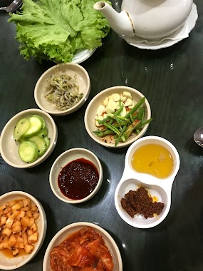
Mannam, Koreyskoye Kafe
Tashkent
Cafe
read more
279 m
Arisu Sarang Restaurant & Sushi Bar
Chehov ko'chasi, Тошкент
Cafe
read more
296 m
Cafe Bon!
38 Chehov ko'chasi, Тошкент
Cafe
read more
310 m
GŌSHT
Tashkent
Cafe
read more
343 m
Dolce Italia
дом, 8 Shahrisabz ko'chasi, Тошкент
Cafe
read more
432 m
Кафе JAGO
Tashkent
Cafe
read more
459 m
Le Caprice Ice Cream
20 Mirobod ko'chasi, Тошкент
Cafe
read more
466 m
Maryam Dessert House
10, Shahrisabz ko'chasi, Тошкент
Cafe
read more
478 m
Paisley Salad Bar
17 Mirobod ko'chasi, Тошкент
Cafe
read more
531 m
Cityzone Playstation Club
улица Мирабадская 39/32А Ташкент UZ
Cafe
read more
533 m
Tochka Vkusa
10 Mirobod ko'chasi, Тошкент
Cafe
read more
583 m
ONNURI FOOD
Tashkent
Cafe
read more
715 m
Konditerka
Avliyoota ko'chasi, Тошкент
Cafe
read more
733 m
Safia MaGdalena
Мирабадский район
Cafe
read more
735 m
Joy Coffee
Chehov ko'chasi, Тошкент
Cafe
read more
802 m
Sushi Bar Yaposha
Yusuf Hos Hojib 32 Ташкент UZ
Cafe
read more
894 m
Black Bear Kofi
39 Shota Rustaveli ko'chasi, Тошкент
Cafe
read more
915 m
Puteshestvennik
86 Nukus ko'chasi, Тошкент
Cafe
read more
951 m
Cake Lab
21 Chehov ko'chasi, Тошкент
Cafe
read more
965 m
Milly Coffee Restaurant
улица Тараса Шевченко, Ташкент, дом
Cafe
read more
994 m
Burger Embassy
2, 12 Yakkachinor Street, Tashkent
Cafe
read more
1.137 km
Adbor uyg'ur taomlari
Tashkent
Cafe
read more
📑
all categories
Accounting
Administrative area level 1
Administrative area level 2
Airport
Amusement park
Art gallery
Atm
Bakery
Bank
Bar
Beauty salon
Bicycle store
Book store
Bowling alley
Bus station
Cafe
Campground
Car dealer
Car rental
Car repair
Car wash
Cemetery
Church
City hall
Clothing store
Colloquial area
Convenience store
Courthouse
Dentist
Department store
Doctor
Electrician
Electronics store
Embassy
Establishment
Finance
Fire station
Florist
Food
Furniture store
Gas station
General contractor
Grocery or supermarket
Gym
Hair care
Hardware store
Health
Hindu Temple
Home goods store
Hospital
Insurance agency
Jewelry store
Laundry
Lawyer
Library
Liquor store
Local government office
Locality
Locksmith
Lodging
Meal delivery
Meal takeaway
Mosque
Movie theater
Moving company
Museum
Natural feature
Neighborhood
Night club
Park
Parking
Pet store
Pharmacy
Place of worship
Plumber
Point of interest
Police
Political
Post office
Premise
Real estate agency
Restaurant
Roofing contractor
Route
Rv park, camping
School
Shoe store
Shopping mall
Spa
Stadium
Storage
Store
Subway station
Supermarket
Synagogue
Taxi stand
Train station
Transit station
Travel agency
University
Veterinary care
Zoo
sublocality level 1
↑