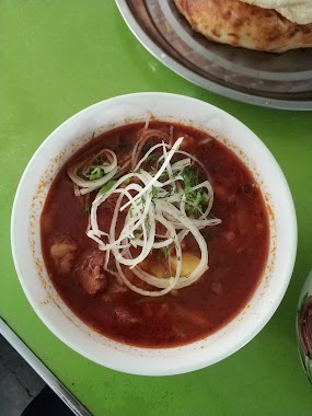
Cafe nearby Кафе IRIS
Uzbekistan
Cafe nearby Кафе IRIS
Кафе IRIS
Andijan, Uzbekistan
contacts phone
:
+998
Latitude:
40.7836816
, Longitude:
72.3490936
larger map & directions
read more
nearest Cafe
147 m
Diydor Chicken tabaka
Uzbekistanskiy Prospekt, Andijan
Cafe
read more
258 m
Kafe Fayz
Andijan
Cafe
read more
271 m
Afro Turk & Grill
10 № cho'lpon ko'cha Andijon shahar O
Cafe
read more
426 m
Rayxon
Andijan
Cafe
read more
516 m
Uzbegim Parkhez Taomlari
Andijan
Cafe
read more
1.224 km
Baland Guzar
40.794539, 72
Cafe
read more
1.527 km
Cafe Versal
Andijon Cafe_Versal, Andijan
Cafe
Food
Point of interest
Establishment
read more
1.529 km
Cafe Versal
Андижан Cafe_Versal, Andijan
Cafe
Food
Point of interest
Establishment
read more
1.538 km
Vladivostok Oshxonasi
Andijan
Cafe
read more
1.573 km
Kafe Uz Durum
Andijan
Cafe
Food
Point of interest
Establishment
read more
1.595 km
kafe ANSOR
Andijan
Cafe
Food
Point of interest
Establishment
read more
2.166 km
Smile Food
Andijan
Cafe
read more
2.214 km
Kafe PALMA
Andijan
Cafe
Food
Point of interest
Establishment
read more
2.249 km
Evro Kalyan Centre
.Piyozpaya), Andijan
Cafe
read more
2.478 km
Papa Lavash
Andijan
Cafe
Food
Point of interest
Establishment
read more
2.612 km
Kafe Ipak Yuli
Andijan
Cafe
read more
2.635 km
Kafe DYUSHES Andijon
Andijan
Cafe
Food
Point of interest
Establishment
read more
2.767 km
Cafe Europa
Andijan
Cafe
Food
Point of interest
Establishment
read more
2.803 km
Limon
Andijan
Cafe
read more
2.809 km
cafe Sim Sim
Andijan
Cafe
Food
Point of interest
Establishment
read more
2.889 km
Burger club
Ulitsa Vorovskogo, Andijan
Cafe
Food
Point of interest
Establishment
read more
2.89 km
Cafe friends
Andijan
Cafe
Food
Point of interest
Establishment
read more
2.999 km
OMAD CHOYXONASI
Andijan
Cafe
Food
Point of interest
Establishment
read more
3.031 km
Kafe Latin
Andijan
Cafe
Food
Point of interest
Establishment
read more
3.729 km
OQSHOM Chayhana
Andijan
Cafe
read more
📑
all categories
Accounting
Administrative area level 1
Administrative area level 2
Airport
Amusement park
Art gallery
Atm
Bakery
Bank
Bar
Beauty salon
Bicycle store
Book store
Bowling alley
Bus station
Cafe
Campground
Car dealer
Car rental
Car repair
Car wash
Cemetery
Church
City hall
Clothing store
Colloquial area
Convenience store
Courthouse
Dentist
Department store
Doctor
Electrician
Electronics store
Embassy
Establishment
Finance
Fire station
Florist
Food
Furniture store
Gas station
General contractor
Grocery or supermarket
Gym
Hair care
Hardware store
Health
Hindu Temple
Home goods store
Hospital
Insurance agency
Jewelry store
Laundry
Lawyer
Library
Liquor store
Local government office
Locality
Locksmith
Lodging
Meal delivery
Meal takeaway
Mosque
Movie theater
Moving company
Museum
Natural feature
Neighborhood
Night club
Park
Parking
Pet store
Pharmacy
Place of worship
Plumber
Point of interest
Police
Political
Post office
Premise
Real estate agency
Restaurant
Roofing contractor
Route
Rv park, camping
School
Shoe store
Shopping mall
Spa
Stadium
Storage
Store
Subway station
Supermarket
Synagogue
Taxi stand
Train station
Transit station
Travel agency
University
Veterinary care
Zoo
sublocality level 1
↑